New: Free trial coming soon!
WinGPS Marine is the navigation app for your Android device. This app allows you to not only set routes, download GRIB-files for weather forecast and connect your easyAIS-wifi device but has many more features. The more developed WinGPS Marine Plus version also provides you with information about currents and tides (for The Netherlands) and allows you to connect your on board instruments, such as wind gauge, depth meter, log and compass.
Coming soon: request a free trial version of WinGPS Marine Plus!
This allows you to experience our handy navigation without any risks.
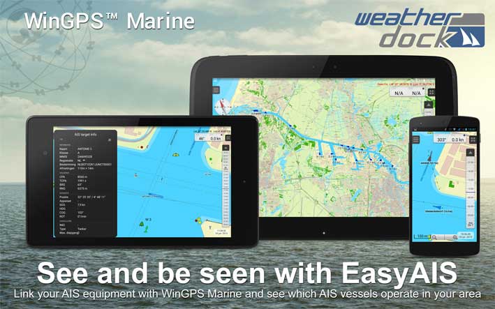
When you connect your EasyAIS wifi to WinGPS Marine, the AIS targets will be shown clearly on your chart, including their name, course and speed. A list of all targets may also be requested. By clicking on a ship in this list, all information will be displayed, such as MMSI, length, width, destination and type.
It is also possible to scale the targets on your chart. This immediately shows you if a small sailing boat or big vessel is coming towards you. Customize the CPA (Closest Point of Approach) and you will receive an alarm if a ship is on collision course.
WinGPS Marine may be used in combination with digital water charts by Stentec Navigation. Try the free DKW ‘Vaarkaart Friese Meren’ or World chart or order your specific charts on www.stentec.com
Download your version of WinGPS Marine and connect your EasyAIS wifi to your Android device.
After the trial period you can easily purchase and connect WinGPS Marine for just €49,99.
The more developed WinGPS Marine Plus costs €99,99.