easyAtoN Type 3 (A20026)
AIS transponder as a navigation aid
To enable nearby ships to identify buoys, beacons or floating objects in real time on the AIS chart display.
AIS AtoN = Aid to Navigation
 |
| 
- Rugged, waterproof and
dust resistant houseing (IP67)
-
Up to 31 real, synthetic and/or virtual navigation marker positions
- Low power consumption
For more information and a non-binding offer, please contact us:
+49 (0)911-376638-30
info@weatherdock.de
Product photos

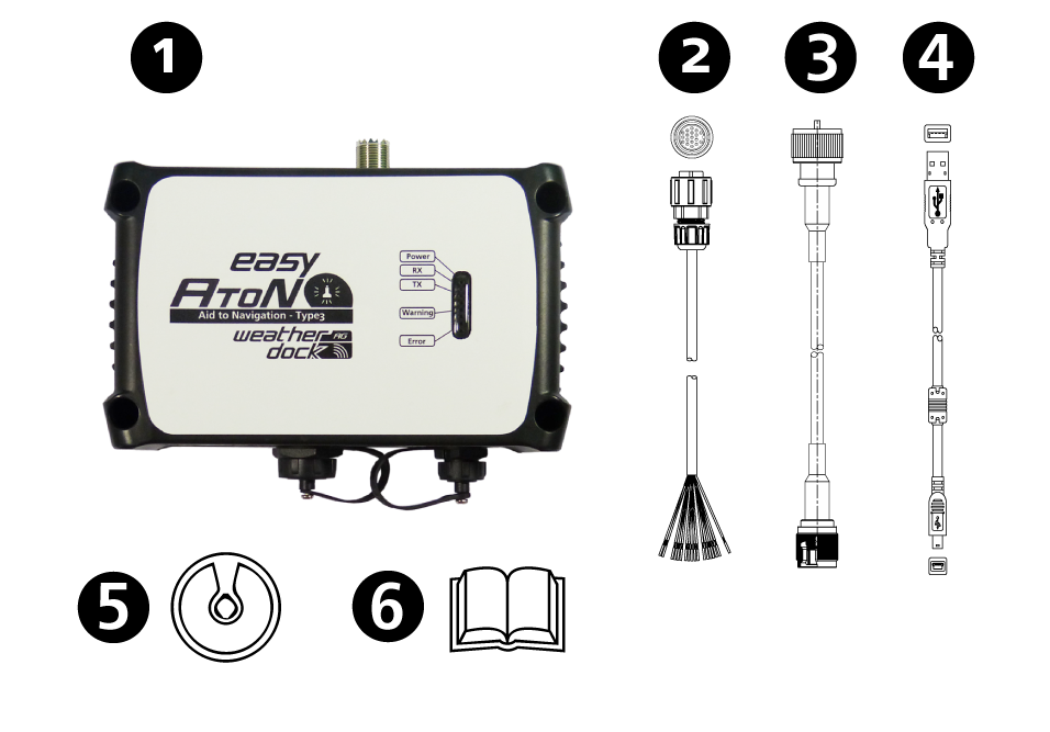
Product information
Function
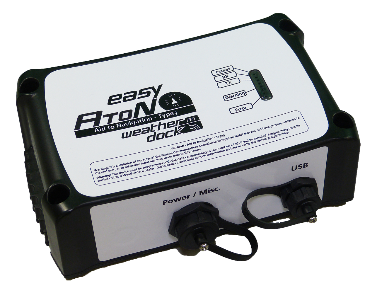
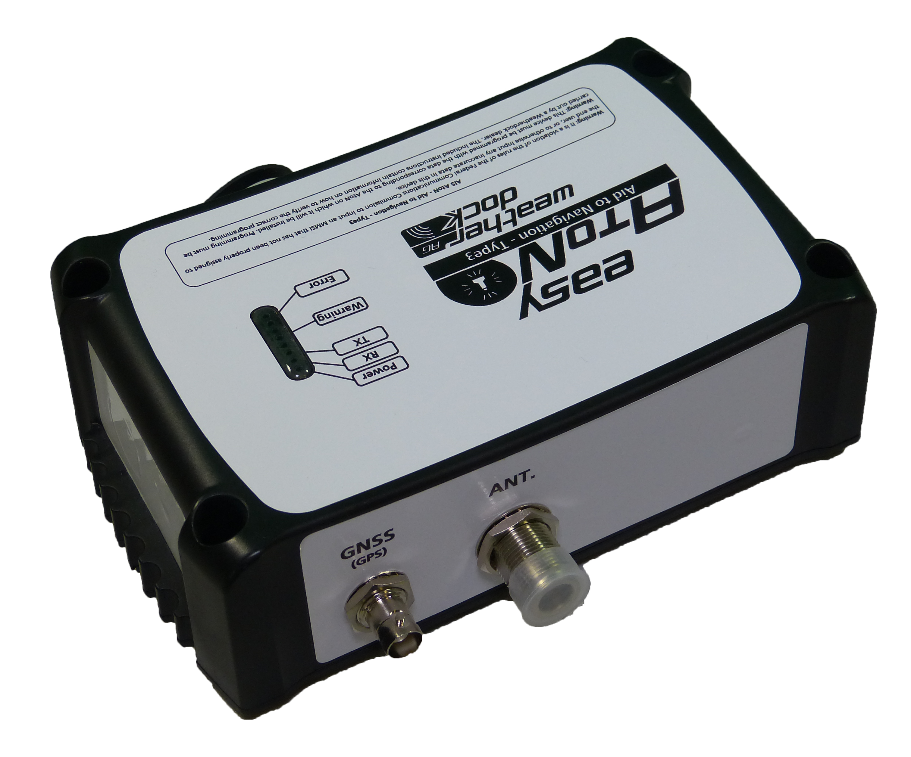
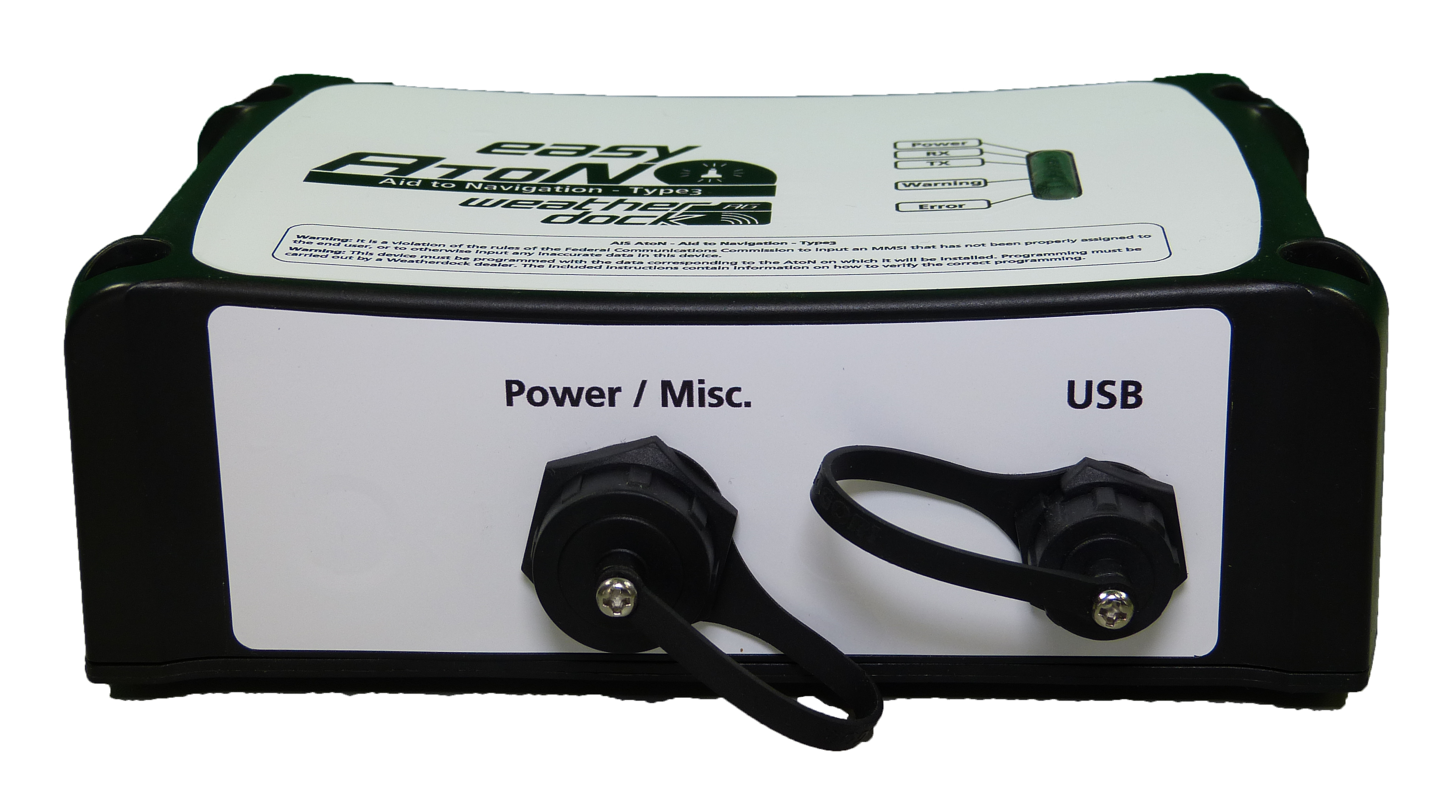
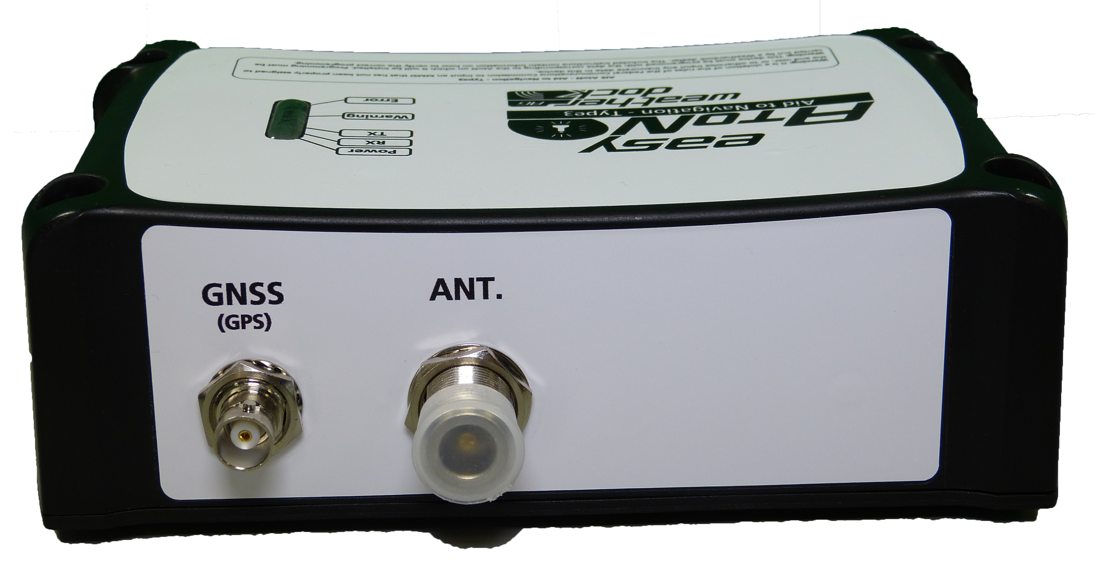
AIS Aid to Navigation (AtoN) transceiver Type 3
The easyAtoN is a Type 3 AIS transponder used as Aid to Navigation station to provide location an identification of buoys, beacons or floating objects to nearby vessels on AIS chart display in real-time.
The easyAtoN has a rugged, waterproof and dust resistant houseing according to protection class IP67. The device can be mounted easily on fixed or floating objects, e. g. buoys to prevent collisions by transmitting the identification and position of the mark. The unit is able to create “synthetic”, “virtual” as well as “real” electronical navigation marks who appear on AIS capable electronic chart plotter or navigation PC-software.
The easyAtoN is developed for the typical usage at marina or harbor entries, maritime warning signs or any kind of fixed or floating navigational marker buoys.
Function
The easyAtoN is a small VHF based AIS transceiver which can e mounted on a buoy or at a pole. With the integrated AIS receiver the easyAtoN can synchronize itself with the AIS time-slot-scheme and transmit the navigation information within the free slots so no message will be overwritten. The syncronization with the AIS traffic can be done by FATDMA or RATDMA.
The easyAtoN uses the AIS system to broadcast up to 31 real, synthetic and/or virtual navigation marker positions to all AIS receivers within the vicinity.
Highlights
- Capability of generating virtual and synthetic AtoN navigation marks
- Integrated GPS Source
- AIS FATDMA or RATDMA (by software selectable)
- Anti-Tamper proof
- Waterproof and dust resistant (IP67)
- Low power consumption
Technical Data
AIS Specification
- Transmitter: 1 Transmitter (AIS1/AIS2)
- Receiver: 2 Receiver (AIS1/AIS2), DSC (AIS Channel Management)
- Frequencies:
- Marine Band: 156,025MHz – 162,025MHz
- AIS1: 161,975MHz
- AIS2: 162,025MHz
- Transmission Power: 5Watt (50Ohm)
- Channel width/grid: 25kHz
- Modulation: GMSK (AIS, TX and RX)
- Transmission rate: 9600bit/s (AIS)
- Sensitivity: -114dBm 25kHz (<20% PER)
- Co-channel rejection: 10dB
- Adjacent channel rejection: 70dB
- Intermodulation: 65dB
- Blocking: 84dB
Power Specification
- Board voltage: 12V DC / 24V DC
- Operating voltage range: 9,6 to 31,2V DC
- Input: 2,9W at 12V DC
- Current consumption: 2A (Senden), 240mA (Stand.) at 12V DC
GNSS
- GPS/GNSS Receiver (internal): 72 Channel GNSS Receiver
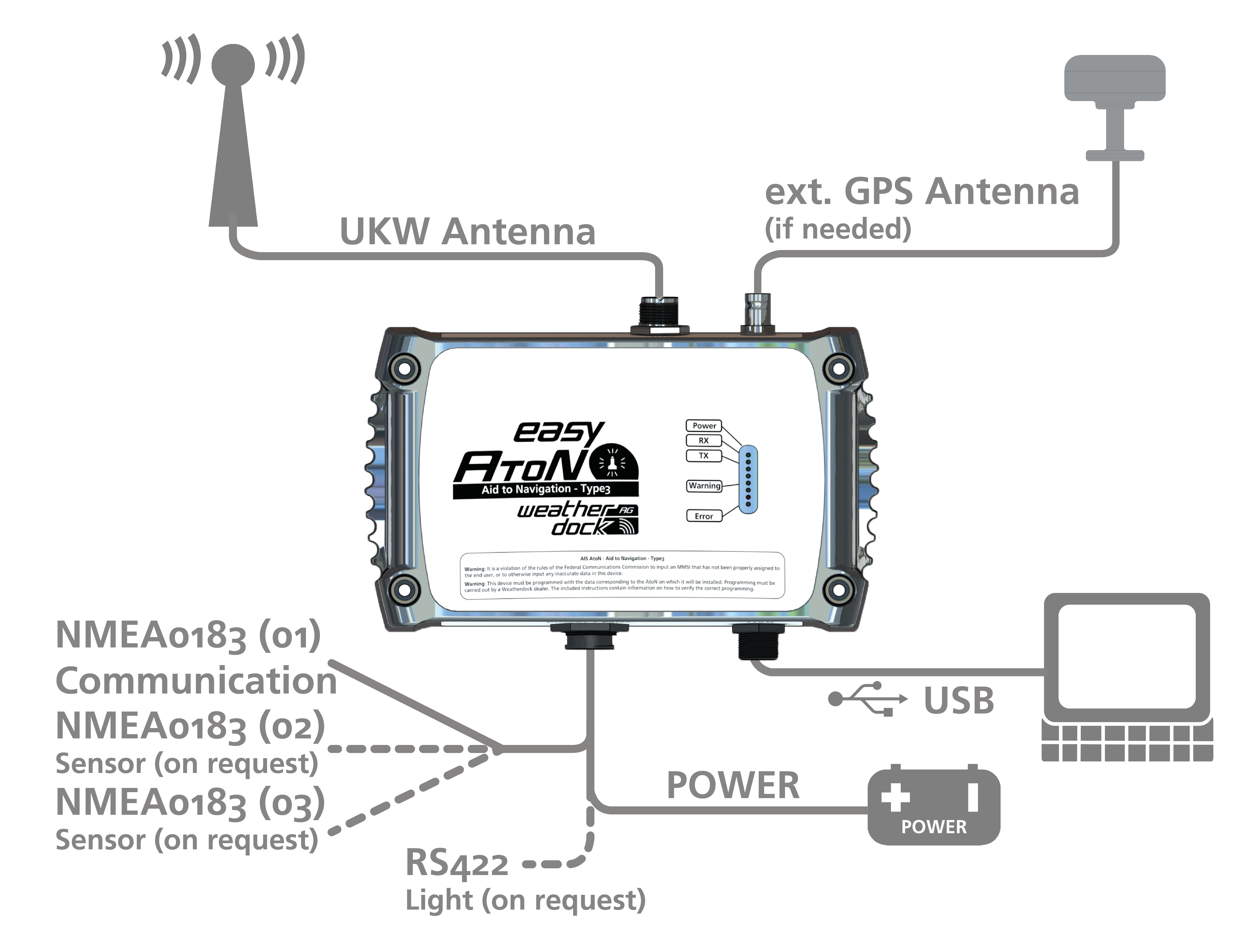
External Connections
- Interfaces: 3x NMEA0183 IN/3x NMEA0183 OUT
- Connections (standard version):
- USB
- 18 pin plug
- VHF antenna connection (N-Connector)
- GPS antenna connection (BNC)
- Data type NMEA output: VDM
General
- Operating temperature: -15 °C to + 55 °C
- Storage temperature: -20 °C to + 75 °C
- Safety distance compass: min. 40 cm
- Dimensions (L/W/H): 195mm x 135mm x 60mm
- Weight: approx. 700 grams
Certifications
- AIS Standards: IEC 62320-2 Ed.2 (2016)
- Environmental: IEC 60945:2002 + Corr.1:2018
- GPS Performance: IEC 61108-1:2003
- Product Safety: EN 60950-1:2006
For more information and a non-binding offer, please contact us:
+49 (0)911-376638-30
info@weatherdock.de
FAQ
You will find answers here!
To frequently asked questions.
What is the easyAtoN Type 3 and what is it used for?
The easyAtoN Type 3 is an AIS AtoN (Aid to Navigation) transponder Type 3 that serves as a navigation aid. It enables nearby vessels to identify buoys, beacons, or floating objects in real time on the AIS chart display. Typical applications include harbor entrances, maritime warning signs, and fixed or floating navigation markers.
What functions does the easyAtoN Type 3 offer?
- Generation of up to 31 real, synthetic, and/or virtual navigation marks: Allows the display of various mark types on AIS-enabled devices.
- Integrated GPS source: For precise positioning.
- AIS FATDMA or RATDMA support: Software-selectable for time slot synchronization.
- Tamper-proof: Protection against unauthorized access.
- Waterproof and dustproof (IP67): Robust housing for use in extreme conditions.
- Energy efficient: Low power consumption for extended operation.
What sets the easyAtoN Type 3 from Weatherdock apart from AtoN Type 3 devices from other manufacturers?
The easyAtoN Type 3 impresses with several unique features:
- Software-based choice between FATDMA and RATDMA for maximum operational flexibility.
- Simple installation and intuitive configuration, ideal for buoys, lighthouses, or offshore applications.
- High-quality signal quality thanks to SOTDMA technology, reliable even in heavily frequented waters.
- Rugged, IP67-certified design for dust- and waterproof use.
- Made in Germany: Development and production in Germany stand for quality and reliability.
This combination makes the easyAtoN Type 3 particularly attractive for professional maritime applications.