easyINFOBOX (A053)
Mobile AIS Receiver with chart plotter
The easyINFOBOX enables the position of
AIS objects in the area to be displayed
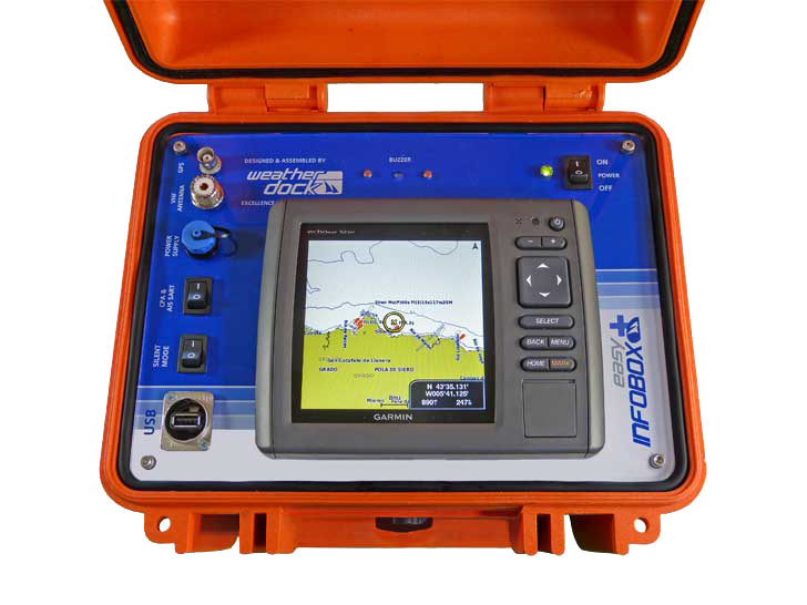
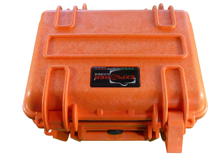
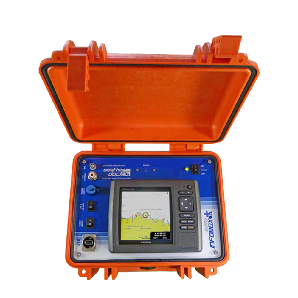
The box is an extremely robust and waterproof PP/ABS box and includes an
autonomous AIS system with AIS receiver and integrated chart plotter.
 |
| 
-
Designed for the mobile usage
of AIS data
- Power supply possible via board net
- Exterior plugs for
GPS and VHF antennas
Product photos
Product information
Product information
The easyINFOBOX-Diving developed by Weatherdock is a shock-proof PP/ABS box with an integrated AIS receiver for diving groups. Is‘s the robust, dust- and water-resistant housing for a AIS unit, receiving the signals from the activated easyDIVEPOS units of the group members which can be displayed by a integrated Chart Plotter. The easyINFOBOX is designed for the mobile usage of AIS data. By means of the DC plug power supply of every board net can be used. The box has exterior plugs for GPS and VHF antennas.
Function The AIS unit inside the easyINFOBOX Divi9ng receives via the connected VHF antenna transmitted signals within a distance of up to 12 nautical miles. The range depends on the receiving height of the VHF antenna. The received data are translated into a NMEA0183 protocols and is transmitted to the Chart Plotter. By connecting the external GPS antenna, the AIS unit receives it‘s own GPS position
Applications
- Helicopter Rescue-Units of oil platforms or offshore wind parks
- Diving groups
- Long-Term regattas with air support
- Charter units
In addition to the regular reception of AIS data, the easyINFOBOX has also been developed to receive the position data of certain objects within a “closed user group” in the function of a mobile headquarters. Such an application can be implemented together with the portable Weatherdock position transmitters, vmsTRACK-PRO, easyAIRDROP, easyRESCUE-DIVE, easyPOS’N’HOOK or iridiumIONEER. These transmitter units send their position reports on a special, encrypted frequency so that only the headquarters are able to display this position data to their own “closed user group”. The use of the easyINFOBOX by diving groups is conceivable, where the INFOBOX remains as a base station on the diving ship. Another possible area of application is mobile surveillance of a specific area, e.g. B. at a regatta. The use of the easyINFOBOX in a rescue helicopter is also conceivable, since the built-in receiver receives the emergency signals from an activated “AIS Search and Rescue Transmitter” despite the predefined “closed user group” and these are displayed accordingly on the chart display device.
Highlights
- Waterproof
- Shockproof
- Dustproof
- IP 67 (at 1 m water depth for max. 30 min.)
- Easy to open and close with two big cover flaps
- Internal AIS receiver with WIFi module
- Exterior plugs for power supply, GPS antenna and VHF antenna
- Signal color orange
- Stainless steel
What is needed?
What is necessary to use the easyINFOBOX?
In order to be able to receive the signals, the INFOBOX must be connected to an VHF antenna. This is normally available on board. The easyINFOBOX is powered by the on-board power supply. A corresponding connection is available in the box. In addition, the easyINFOBOX has the option of connecting an external GPS antenna. In addition, a separate signal generator for CPA alarm and incoming AIS S.A.R.T. Distress messages integrated into the box, which can be switched on or off with a switch if required. The user has to provide the map material for the map display device for the respective area of application himself. In order to be able to display the different positions of the “closed user group”, each object must be equipped with a portable VHF position transmitter. i.e. 1x easyPOSALERT per boat in a regatta, 1x easyRESCUE-DIVE per diver in a diving group, etc. The portable VHF position transmitters are not included in the delivery of the easyINFOBOX. Devices other than the devices listed at the beginning cannot be operated as a “closed user group”.
Technical Data
- Dimensions (L x W x H):
External dimensions: 27 x 24.6 x 17.4 cm
Inside dimensions: 25.1 x 17.8 x 15.5 cm - Weight: about 5 kg
- Operating temperature range: -40°C to 99°C
- Housing: Polypropylene
- Snap closure: ABS (plastic)
FAQ
You will find answers here!
To frequently asked questions.
What is the easyINFOBOX A053?
The easyINFOBOX is a mobile AIS receiver with an integrated chart plotter. It receives position data from AIS objects and special transmitting devices from closed user groups and displays them visually.
What is the easyINFOBOX intended for?
- Diving groups, where the ship or base boat can display the received positions of the divers on the easyINFOBOX.
- Mobile operations such as regattas with air support, offshore operations, and helicopter rescue units.
- Securing areas (“mobile operations center”) where the position of various objects needs to be monitored, e.g., boats, markers, divers, etc.
Which signals does the easyINFOBOX receive?
- AIS signals from all AIS vessels within range.
- Position reports from objects in a closed user group, e.g., with devices such as easyRESCUE-DIVE, vmsTRACK-PRO, easyPOSALERT, etc. These transmit on an encrypted “special frequency” that can only be decoded by the easyINFOBOX (or similar authorized receivers).
What does “Closed User Group” mean?
Certain objects (e.g., divers, boats, markers) transmit position data on a special, encrypted radio frequency so that only authorized receivers like the easyINFOBOX can view this data. This protects privacy and prevents position data from being publicly visible.
What is necessary for the easyINFOBOX to work?
- A VHF antenna connected to the box.
- Power supply via the vehicle’s electrical system via a DC plug or other compatible power supply.
- Optional: an external GPS antenna if you want your own GPS positioning data.
- For closed user groups: the individual objects must be equipped with appropriate transmitters. These transmitters are not part of the box.
When is the easyINFOBOX particularly advantageous?
- Mobile operations center, e.g., on a dive vessel or rescue boat.
- When multiple mobile objects need to be monitored, even at greater distances.
- When visual contact is lost and position data still needs to be displayed.
- For rescue units (e.g., helicopters or offshore facilities) for a quick overview of AIS vessels and friendly units.